


Drones Take on Dangerous Mining Sites
Explore how EyeROV’s iBoat Alpha Autonomous Surface Vehicle (ASV) transforms bathymetric surveys in hazardous mining and quarry ponds. Discover its advantages in safety, cost-effectiveness, and productivity, while enabling accurate depth profiling, floating solar power planning, and sustainable post-mining site management.
Survey of Ponds in Quarry/Mining Sites
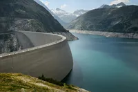
Water bodies or ponds formed within mining and quarry sites are typically deep and often pose significant hazards. Accurate surveying of these ponds is essential to understand their depth profile, monitor sediment or mineral deposit accumulation, track water quality, and support mine closure planning, as well as post-mining land use strategies.

However, conducting such surveys using conventional methods can be extremely risky due to factors such as steep underwater slopes, considerable water depths, and high turbidity that severely limit visibility. Additionally, the potential presence of chemical or metal contaminants in the water can pose serious health risks to humans.
An effective alternative is the use of Autonomous Surface Vehicles (ASVs), which are unmanned systems equipped with advanced sensors and navigation technologies. ASVs enable safe, efficient, and accurate bathymetric surveys of quarry and mining ponds without exposing human operators to these hazards.
Recommended Approach
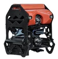
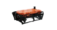
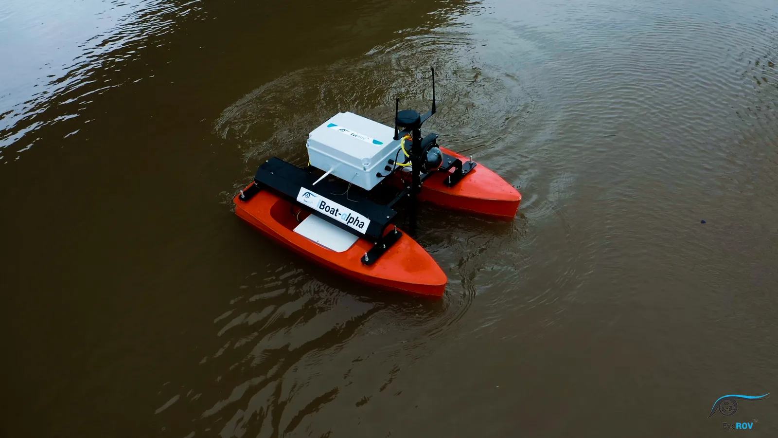
The EyeROV iBoat Alpha is a fully integrated autonomous platform specifically designed for hydrographic surveys and a wide range of related applications. Equipped with advanced autonomous navigation capabilities, the iBoat Alpha streamlines the conventional labor-intensive process of hydrographic surveying, resulting in significant savings in both time and manpower.
Engineered for versatility, the iBoat Alpha supports seamless integration with multiple payloads and instruments, including single-beam and multibeam echo sounders, side-scan sonars, sub-bottom profilers, water quality sensors, and ADCP systems, ensuring the collection of accurate, high-quality data.
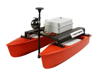
By integrating the iBoat Alpha with a single-beam echo sounder, EyeROV was able to successfully deploy the device for a bathymetry survey of a quarry pond. This report presents the main findings from the survey, which was conducted in accordance with accepted best practices.
Advantages of Autonomous Surface Vehicles Over Conventional Approaches
Autonomous Surface Vehicles (ASVs) offer several advantages over conventional bathymetry survey methods, such as:
1. Autonomy and Productivity
ASVs operate autonomously, eliminating the need for human supervision during bathymetric surveys. This automation increases productivity by allowing surveys to be carried out continuously without mobilizing traditional manned systems.
2. Safety and Risk Reduction
ASVs replace human operators in high-risk areas, enhancing safety during operations. ASVs can access remote and hard-to-reach locations, minimizing risk to personnel.
3. Cost-Effectiveness
ASVs provide a more affordable alternative to crewed survey vessels. They reduce operational costs, contributing to overall cost-effectiveness in bathymetry surveys.
✅ In summary, ASVs enhance efficiency, safety, and accuracy, making them an invaluable tool for underwater mapping in mining environments.
Project Scope
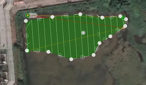
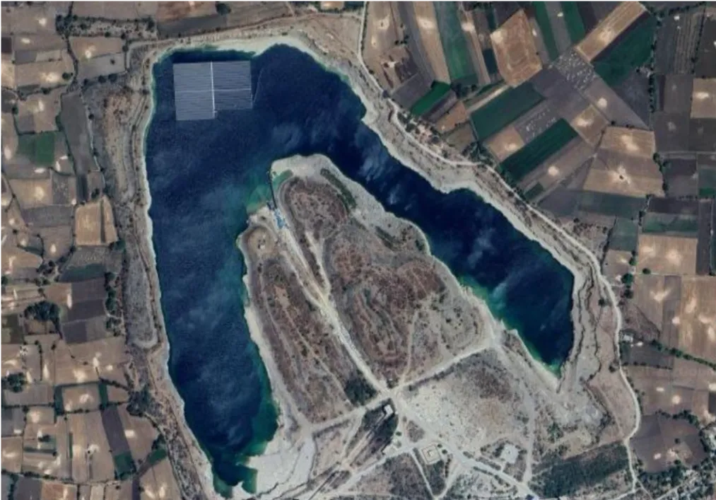
The project scope involved conducting a bathymetric survey for the establishment of a floating solar power plant, covering an area of approximately 33 hectares.
Survey Execution
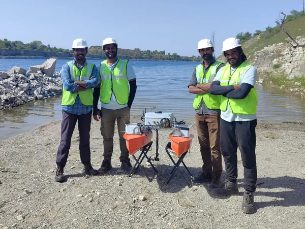
The survey followed four stages: preparation, data collection, processing, and reporting.
Using the EyeROV iBoat Alpha ASV integrated with a single-beam echo sounder and RTK DGPS, data acquisition for bathymetry was conducted along 2m spaced survey lines at a uniform speed of 1.2m/s with depths corrected to the Client’s reference level using tide pole readings.
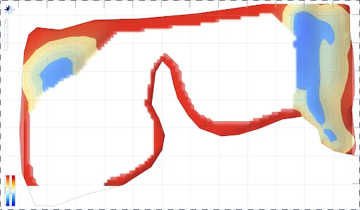
The processed results ensured accurate and reliable bathymetric reporting.
Key Insights
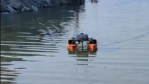
About 33 hectares of abandoned mines which was unsafe for human entry, could be surveyed effectively in few days with no human intervention using advanced ASV systems.
Based on the ASV survey conducted in the quarry, the following conclusions were drawn:
- All depth measurements have been adjusted to the water level observed during the survey period.
- A detailed bathymetry chart was generated from the readings.
- The survey region had a lot of edgy rocks and navigation hazards, which could have been fatal for human boat-based surveys, but didn’t pose any threat for ASV surveys.
- The climate was extremely hot and challenging, but didn’t impact as the survey was done using ASV and further the mobilisation and demob was also done quickly due to small and portable platforms like i-Boat Alpha being used.
Conclusion
Bathymetry surveys in quarry ponds play a crucial role in ensuring safe and sustainable utilization of these water bodies.
By providing accurate data on depth profiles and underwater topography, such surveys help identify potential hazards, ensuring safety for workers, equipment, and future users. They also enable precise volume and capacity estimation, which is essential for effective water resource management and flood control.
From an environmental perspective, bathymetry helps in monitoring sedimentation patterns, assessing habitat conditions, and supporting ecological rehabilitation. Furthermore, the data serves as a foundation for planning industrial applications such as floating solar panel installations, dredging operations, or the conversion of quarry ponds into reservoirs.
In this way, bathymetric surveys act as a critical tool that bridges safety, environmental protection, and industrial development in quarry pond management.
For more on how ASVs are transforming hydrographic surveys, check out our insights on revolutionizing hydrographic surveys with autonomous surface vehicles.