


Deep-sea corals of Lakshadweep: the reefs you don’t see, the risks we already measure, and how ROV surveys can change what we know
Lakshadweep’s deep-sea corals remain largely unseen. Learn why deeper reefs matter, how pollution and heat stress affect them, and how ROV surveys can reveal hidden habitats.
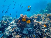
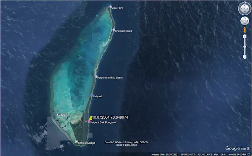
When people talk about “Lakshadweep corals,” they usually mean the postcard version: bright lagoons, shallow reef flats, and sunlit coral gardens. But Lakshadweep sits on a large undersea ridge system that drops away into deeper water. That deeper zone, reef slopes, ledges, hardgrounds, and current-swept features, is where deep-sea (cold-water) corals and other habitat-forming organisms can occur, often far beyond diver depth.
Here’s the problem: we have real data showing Lakshadweep’s shallow reefs are under increasing stress, but we have far less direct, site-level information about what lies deeper. If we want to understand reef resilience, biodiversity hotspots, and where conservation or monitoring should focus next, the future is “depth-aware” science—built on repeatable underwater observations rather than assumptions.
Lakshadweep in context: why deep-sea corals are plausible here
Lakshadweep is part of the Chagos–Lakshadweep (Chagos–Laccadive) ridge/plateau system, a prominent volcanic ridge and oceanic plateau stretching across the Indian Ocean.
That matters because deep-sea coral habitats commonly occur where you have:
- Hard substrate (rocky outcrops, consolidated rubble, carbonate hardgrounds)
- Steady currents (bringing plankton and organic particles for filter feeders)
- Complex seafloor (ridges, slopes, knolls, escarpments)
The ridge setting suggests there are likely candidate zones, especially on slopes and drop-offs, where deep-water coral communities could exist. But “likely” is not enough. You only learn where they are (and whether they’re healthy) by seeing and mapping them.
What deep-sea corals are (and what makes them different)
Shallow tropical corals depend on sunlight and symbiotic algae. Deep-sea corals don’t. Many are suspension-feeders living in darkness, including:
- Cold-water stony corals that can build reef-like frameworks
- Octocorals (gorgonians/sea fans/soft corals) that form complex “underwater forests”
- Other structure-formers that create habitat for fish and invertebrates
Deep-sea coral habitats can be biodiversity “hotspots,” but they are often slow-growing and highly sensitive to sedimentation, debris, and physical disturbance.
The strongest signal we already have: shallow reefs are declining
Even before we talk about deep reefs, Lakshadweep’s shallow reef record points to a clear trend: repeated thermal stress and bleaching events are reshaping reef conditions over time.
Data points from long-term observations and reporting
- A long-term study across Lakshadweep atolls reported coral cover declining from ~37.24% (1998) to ~19.6% (2022), about a ~50% reduction over 24 years.
- The same reporting ties major damage periods to marine heatwaves/ENSO-linked bleaching and highlights that recovery often requires long “quiet windows” without bleaching.
- During the global bleaching conditions in 2024, Lakshadweep was widely described as among the worst affected regions on India’s coastline.
Why this pushes us deeper
A common conservation idea is that deeper reefs might act as refuges. But evidence from other regions shows deep reefs are not guaranteed safe havens during marine heatwaves, temperature stress can penetrate deeper than expected, and local conditions matter.
So the question isn’t “do deep reefs help?” The real question is:
What habitats exist at depth around Lakshadweep, and how do they behave during stress events?
Pollution and debris: a risk that doesn’t stop at the lagoon edge
Deep habitats can be affected by what happens in shallow water and on land. Fine plastics and debris can travel, sink, and accumulate, especially along slopes and in depressions.
Microplastics: measured concentrations
A recent study assessing microplastics across Lakshadweep reports:
- Surface seawater: roughly 10.75 ± 6.18 to 211.5 ± 207.31 items/m³
- Sediments: roughly 54 ± 21.48 to 124.25 ± 76.63 items/kg
Popular reporting summarizing the same research has quoted average values around ~57 particles/m³ in seawater and ~97 particles/kg in sediments, with fragments/fibres often <1 mm and common polymers such as polyethylene/polypropylene/PET.
Why it matters for deep-sea corals:
- Many deep-water corals are particle-sensitive: sediment dusting can reduce feeding efficiency and smother polyps.
- Slope zones can act like “collection belts,” concentrating fine particles and debris over time.
The knowledge gap: deep-sea corals are likely, but not well mapped
We have a growing body of evidence on shallow reef stress, bleaching, and pollution. What’s missing is the “third dimension”: a depth-resolved map of habitats and coral communities, including:
- Where hard substrates occur at depth
- Which depth bands host coral frameworks vs rubble vs sediment
- Where debris accumulates
- Which sites are stable enough to become long-term monitoring stations
This gap exists because deep habitats are expensive to survey—unless you use a tool designed for it.
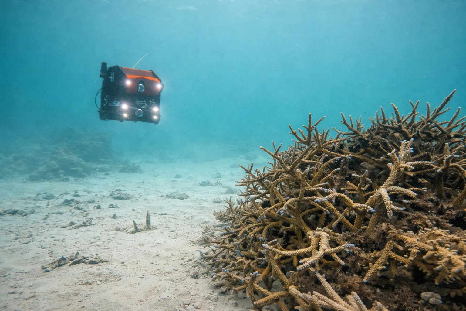
Why ROV-based surveys are a practical bridge from “unknown” to “measured”
An ROV doesn’t just capture underwater video. Done properly, it generates repeatable, analyzable datasets:
What a robust ROV coral workflow looks like
- Pre-survey targeting
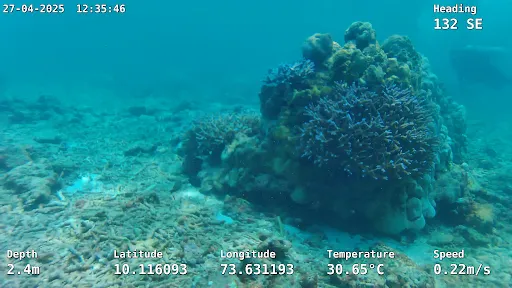
Use bathymetry/slope knowledge to shortlist likely hardground zones, reef edges, and drop-offs (especially where currents are expected). - Structured transects
Fly consistent paths and heights above bottom, record stable video and stills, and log navigation data for georeferenced outputs. - Measurement and habitat classification
Use scaling (e.g., laser) to measure coral colony size, framework height, rubble dimensions, and structural complexity proxies. - Repeat monitoring
Re-run the same transects after bleaching seasons or storms to quantify change: mortality, breakage, debris deposition, recovery.
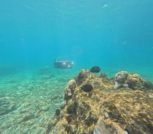
EyeROV in Lakshadweep: two real-world case studies (client name omitted)
To make this concrete, here are two Lakshadweep coral documentation examples showing how an ROV survey becomes a data product.
Case Study 1 — Coral Reef Survey (Lakshadweep) | 24 April 2025 | 4 days
Mission type: Underwater videographic reef survey using ROV (exploration + documentation)
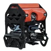
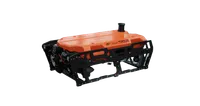
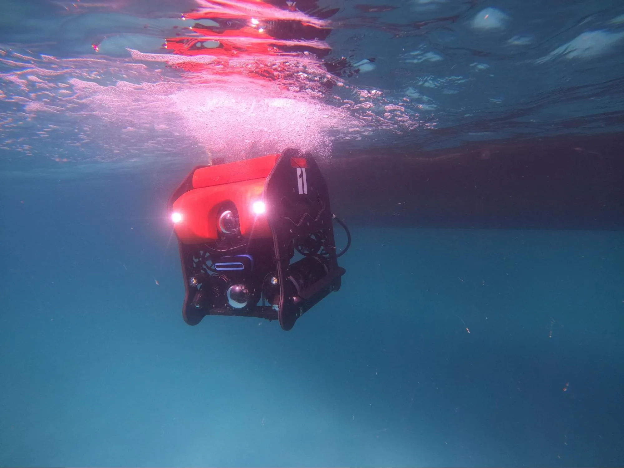
ROV platform used: EyeROV TROUT
Objective (what the mission set out to do)
- Generate high-quality visual documentation of coral reef habitats using ROV videography
- Capture imagery suitable for post-processing enhancement and reporting
- Support reef assessment by recording reef condition indicators visible in video/stills (e.g., coral morphology, rubble presence, visible damage, fish assemblage context)
Scope of work (what was executed)
- ROV-based videographic survey across reef zones (as per site plan)
- Continuous recording of reef features during transects (camera-forward navigation)
- Visual coverage designed for later selection of key frames/stills for reporting
Operational setup (resources required)
- Generator (field power support)
- Tether system (real-time control + data feed)
- Manpower (ROV ops + support)
- Electronic hardware (integration and mission support)
Data handling & processing (how raw footage became usable outputs)
-
Raw imagery enhancement using:
- EVAP (in-house image enhancement tool)
-
Enhancement workflow aimed at improving:
- contrast in variable visibility
- detail recovery in reef textures
- clarity of key frames used in the report
Deliverables (what was produced)
-
Consolidated findings delivered as:
- Soft copy report
- Hard copy report
-
“Detailed report” referenced in the case-study source deck (linked from slide)
Case Study 2, Coral Reef Inspection (Lakshadweep / Agatti referenced) | 28 April 2023 | 5 days
Mission type: Underwater videographic reef inspection using ROV (documentation condition-focused inspection)
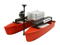
ROV platform used: EyeROV Tuna
Objective (what the mission set out to do)
- Inspect coral reef areas using ROV videography
- Produce a visual record suitable for reporting and comparison
- Capture reef condition and habitat context imagery in a structured inspection format
Scope of work (what was executed)
- Underwater videographic survey using ROV to explore coral reef at the island (Agatti referenced in scope)
- Visual inspection passes over reef habitat to capture:
- branching coral fields (where present)
- reef structure and relief
- fish presence and habitat association (contextual)
Operational setup (resources required)
- Generator
- Manpower
- Tether
- Electronic hardware
Data handling & processing (how raw footage became usable outputs)
-
Raw imagery enhancement using:
- EVAP (in-house enhancing tool)
-
Goal: improve usability of frames for reef condition interpretation and reporting consistency
Deliverables (what was produced)
-
Consolidated findings delivered as:
- Soft copy report
- Hard copy report
-
“Detailed report” referenced in the case-study source deck (linked from slide)
Why this case study is important for deep/mesophotic coral exploration
- Adding side scan sonar is particularly useful when scaling toward deeper surveys:
- you can scout larger areas first,
- then spend camera time only where the sonar suggests hardground/structure.
What ROV datasets can reveal about deep-sea corals around Lakshadweep
If Lakshadweep’s next research frontier is deeper slopes and offshore structures, an ROV-led program can generate the missing “depth layer” with outputs like:
- Depth distribution: coral presence/absence by depth bin (e.g., every 10 m or 20 m)
- Habitat mapping: rock vs rubble vs sand vs framework, linked to sonar and video
- Colony metrics: sizes and partial mortality estimates using laser scaling
- Threat indicators: debris counts, gear interactions, sediment dusting index
- Change detection: repeat surveys after heat stress years or storm seasons
This matters because shallow reef trends already show the need for better management windows and recovery time.
Deep-sea coral and slope habitats—if mapped—can become part of a smarter conservation and monitoring plan rather than remaining a blind spot.
The takeaway
Lakshadweep’s shallow reefs have enough data to say this confidently: stress events are frequent and reef trajectories are shifting.
Microplastics and debris are measurable and widespread.
What we don’t yet have, at the same resolution, is a verified picture of deeper habitats where deep-sea corals may exist.
That’s where ROV surveys become decisive: they convert “likely habitats” into maps, measurements, and repeatable baselines. In Lakshadweep, that’s not just exploration—it’s the foundation for the next decade of reef science and resilience planning.
Sources (data and references used)
Coral cover decline & reef change
- Down To Earth summary of 24-year Lakshadweep reef study and coral cover change (1998 to 2022):
- PDF reporting the 24-year decline headline figure (37.24% to 19.6%):
- Drishti IAS summary referencing the long-term study title and drivers (marine heatwaves, filtering, composition trends):
2024 bleaching context
- Down To Earth report describing Lakshadweep as worst-affected by coral bleaching on India’s coastline and linking to global bleaching conditions:
Microplastics
- ScienceDirect paper on microplastics across Lakshadweep (reported ranges in seawater and sediments):
- Outlook Business summary quoting average microplastic concentrations (~57 particles/m³ seawater; ~97 particles/kg sediments) and polymer types:
Geologic context (ridge system)
- Background overview of the Chagos–Lakshadweep ridge/plateau:
- ScienceDirect paper on Chagos–Laccadive ridge as a volcanic ridge/plateau (geophysical context):