




Multibeam Bathymetry vs. Side Scan Sonar: Pipeline Guide
Compare multibeam bathymetry and side scan sonar for offshore pipeline route and span surveys, and learn which sonar technology fits your project best.
Offshore pipeline projects need an accurate picture of the seabed before pipe goes in the water, and ongoing monitoring for as long as the pipeline stays in service. Two sonar technologies do most of that work: multibeam bathymetry (MBES) and side scan sonar (SSS).
They get mentioned together often, and sometimes confused with each other, but they measure different things and answer different questions. This guide compares the two for pipeline route and span surveys and looks at when a project needs one, the other, or both.
Understanding multibeam bathymetry (MBES)
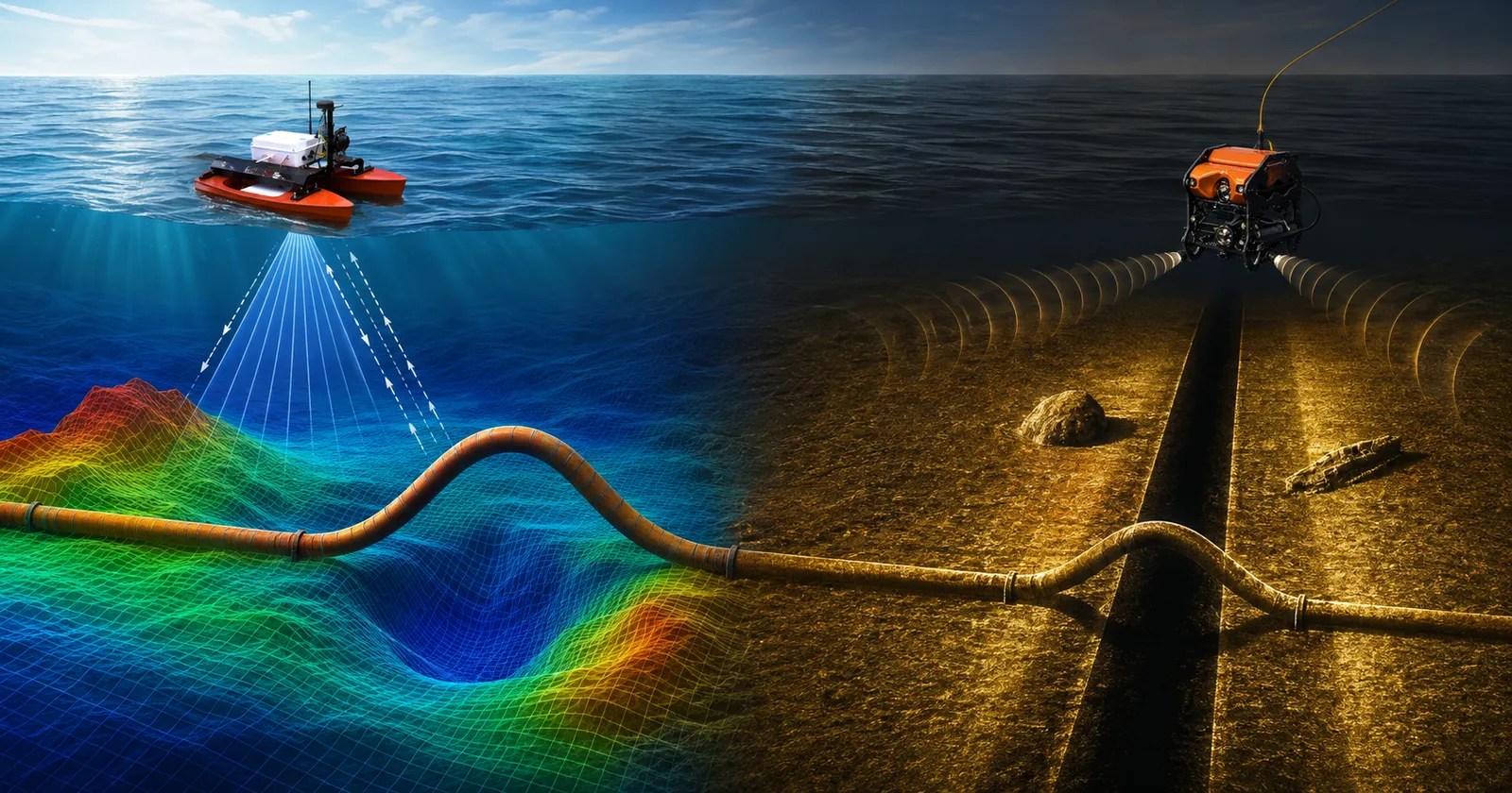
Multibeam bathymetry uses a transducer array, mounted on a vessel hull, an ROV, or an AUV, to send many sonar beams at once in a fan shaped pattern across the seabed. The system times each beam’s round trip and converts it into a depth measurement, and thousands of these points together build a three dimensional map of the seafloor.
MBES also records backscatter, the strength of the returning echo, which gives a rough read on seabed composition since hard surfaces like rock reflect sound more strongly than soft mud.
A single MBES pass covers a wide swath, which makes it efficient for mapping large areas. It is a standard tool for planning pipeline routes, inspecting pipelines already in place, and general hydrographic charting. One tradeoff: resolution drops in deeper water as the beams spread out, so deep water surveys often mount the sonar closer to the seabed to keep detail sharp.
What is side scan sonar?
Side scan sonar takes a different approach. Instead of measuring depth, it emits acoustic pings out to both sides of the sensor, and each ping returns a single line of acoustic reflection data across the swath, not a full image.
The sonar head, typically towed on a towfish or mounted to an ROV or AUV, moves forward in a straight line at steady speed, and each new ping adds the next line of data. The 2D mapping is built by combining these successive lines based on the heading and movement of the vehicle or using a waterfall display, rather than the sensor scanning the area on its own.
Objects that rise from the seabed, such as boulders, debris, or an exposed section of pipe, reflect sound strongly and appear lighter in the image, while flat sand or mud returns a weaker echo and appears darker. This contrast makes side scan sonar effective at spotting discrete objects and texture changes along a survey corridor. It cannot measure depth on its own, so it does not replace bathymetric data. What it adds is detail: a picture of what sits on the seabed and how the surface changes along a route.
Multibeam bathymetry vs. side scan sonar: key differences
The two technologies measure different properties, and that shapes where each fits. MBES measures depth directly, so it answers questions about elevation, gradient, and free span height. Side scan sonar measures acoustic reflectivity and produces an image, so it answers questions about what objects are present and how the seabed surface looks.
MBES gives full coverage bathymetry across a swath, useful for route corridors and terrain modeling. Side scan sonar gives higher resolution imagery of the seabed surface, useful for spotting individual objects. MBES data feeds engineering work such as slope analysis and free span identification, while side scan sonar data supports object detection and visual condition reporting. Neither technology replaces the other, and which one leads depends on the specific question the project needs answered.
Which technology is better for pipeline route surveys?
MBES and side scan sonar solve different parts of the same problem, so which is better depends on the survey stage. Early in route planning, when the goal is mapping terrain and ruling out unsuitable seabed sections, MBES bathymetry is the primary tool, giving planners a continuous elevation model that route engineering and geotechnical assessment need as inputs.
Once a candidate route is identified, side scan sonar adds value by revealing what is actually sitting on that seabed, whether boulders, existing infrastructure, or debris that a bathymetric model alone might miss. Most route clearance surveys run both systems together, often on the same pass, so the two data sets line up spatially and can be reviewed side by side.
Using MBES and side scan sonar for pipeline span surveys
Free spans, sections where a pipeline is suspended above the seabed rather than resting on it, are one of the more important things a pipeline integrity survey needs to catch, since left unaddressed they can lead to vibration, fatigue, and structural damage.
MBES is well suited to measuring free spans because it captures the elevation profile of both the pipeline and the surrounding seabed, letting engineers calculate span length and the height of the gap underneath. Side scan sonar adds a complementary view, highlighting scour and erosion that often cause spans to form, and confirming visually where the pipe lifts clear of the seabed. Running both together gives engineers a measured profile and visual context in one survey.
When should both technologies be used together?
Combining MBES and side scan sonar makes sense whenever a project needs both an accurate depth model and a detailed picture of seabed conditions, which describes most pipeline route and integrity surveys.
Typical situations include new route planning over unsurveyed seabed, as built surveys after installation, periodic integrity checks on aging pipelines, and surveys ahead of maintenance work. Running both sonar types on the same platform, rather than as separate mobilizations, keeps the data sets aligned in position and timing.
Factors to consider before selecting a survey method
The survey objective matters most. A depth model or free span measurement calls for MBES, while an inventory of seabed obstructions or a visual condition record calls for side scan sonar. Water depth and seabed complexity affect resolution too, since deeper water reduces MBES resolution unless the sonar sits close to the seabed.
Pipeline age plays a role as well: a newly laid pipeline survey often prioritizes as built documentation, while an older pipeline nearing a scheduled check may need closer attention to span development and scour. Budget and schedule matter too, since running both sonar types adds mobilization time and processing effort. Client or regulator deliverable requirements often settle the question directly.
How ROVs enhance pipeline route and span surveys
Both MBES and side scan sonar depend on how close the sensor gets to the seabed and how steadily it holds a survey line, which is where ROV deployment adds value over vessel mounted systems alone.
An ROV carrying a sonar payload, whether multibeam, side scan, or both, can fly a controlled, repeatable line close to the seabed regardless of surface conditions, which matters most in areas with difficult access, such as congested infrastructure zones or shallow sections a surface vessel cannot safely approach. ROVs also let survey and inspection run on the same dive, collecting sonar data alongside visual camera inspection in one pass.
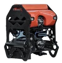
EyeROV’s SAGARA ROV is built for this kind of subsea survey and inspection work, capable of carrying sonar and imaging payloads suited to pipeline route and span assessments. Data collected during these surveys can be processed through EVAP, EyeROV’s post processing analytics platform, to organize inspection findings for engineering review.
Readers new to the technology can start with EyeROV’s guide on what an ROV is and how ROV inspection works.
Delivering accurate pipeline surveys for safer offshore operations
Multibeam bathymetry and side scan sonar answer different questions about the seabed, and offshore pipeline projects generally need both for a complete picture. MBES gives the depth model that route planning and span assessment depend on, while side scan sonar adds the detail needed to identify obstructions and seabed condition along the route.
Choosing the right combination depends on the survey objective, water depth, pipeline condition, and what the client or regulator requires as a final deliverable. Getting this right at the planning stage avoids the far higher cost of an issue discovered later.
Make every offshore survey more accurate
Reliable sonar data is the foundation of safe pipeline operations. Whether planning a new route or assessing existing infrastructure, combining the right survey technology with experienced ROV operations leads to better decisions, reduced risk, and stronger asset integrity.
Discover how EyeROV’s Oil & Gas inspection services deliver precise pipeline surveys, advanced sonar inspections, and dependable offshore data collection.
Explore EyeROV’s ROV solutions and equip your offshore surveys with the precision needed for confident pipeline inspection and seabed mapping. Get in touch to discuss a pipeline survey requirement.
Frequently Asked Questions
Can MBES detect pipeline free spans?
Yes. Multibeam bathymetry captures the elevation profile of both the pipeline and the surrounding seabed, which lets engineers measure span length and the height of the gap beneath a suspended section. This data feeds directly into assessments of whether a free span needs repair or support.
Is side scan sonar used for seabed mapping?
Yes, though it maps the seabed differently than MBES. Side scan sonar produces a detailed image of seabed texture and objects based on acoustic reflectivity rather than a depth surface, and it is commonly used alongside bathymetric data to build a complete picture of seabed conditions.
Which industries use MBES and side scan sonar?
Both technologies are used across offshore oil and gas, hydrographic surveying, ports and harbor authorities, dredging and marine construction, offshore wind, and marine research, wherever a detailed and accurate understanding of the seabed is required.