


What Is Sonar? A Guide to Underwater Detection
Sonar scanning uses sound waves to detect and map underwater environments. Learn how it works, types of sonar systems, and key applications in offshore inspection and ROV operations.
Sonar- sound navigation and ranging, uses acoustic pulses to detect and map what exists underwater. While light and radar fails underwater, sound works. In offshore inspection, marine surveying, and ROV navigation, sonar is the primary tool for seeing below the water surface.
What is Scanning Sonar?
Sonar emits a pulse of sound into the water. When the pulse strikes an object or the seabed, it reflects back as an echo. The system measures the time between transmission and return to calculate distance and position. Advanced systems process these returns into detailed images of targets and terrain.
Unlike single-beam sonar, which returns one depth reading directly below, scanning sonar sweeps a wide arc or full 360 degrees. This builds a continuous acoustic picture of the surrounding environment without requiring the vessel or ROV to move extensively.
How Scanning Sonar Works
Sound Waves and Echo Detection
A sonar transducer converts electrical energy into a sound pulse and transmits it into the water column. The pulse reflects off any object in its path and returns to the transducer. The time between emission and reception, combined with the known speed of sound in water, gives the precise range and orientation of the target.
Acoustic Beam Patterns and Target Reflection
Beam width determines coverage and resolution. Narrow beams produce sharper images over smaller areas. Wide beams cover more ground with less detail. High frequencies deliver fine resolution at shallow depth. Low frequencies reach deeper but return less image detail. The right combination depends on the operational requirement.
Interpreting Sonar Images and Echoes
Hard, dense targets return strong echoes, displayed as bright returns. Softer materials or greater distances produce weaker returns. Multibeam systems process thousands of beams simultaneously into georeferenced 3D maps. Side scan sonar produces imagery resembling an aerial photograph of the seabed, with shadows indicating height and structure.
Traditional Sonar vs Scanning Sonar
Coverage and Imaging Differences
Single-beam sonar returns one depth value directly below the transducer. Scanning sonar builds a picture across a wide arc from a fixed or slow-moving platform, without requiring extensive submersible movement.
Accuracy and Resolution Capabilities
Modern multibeam systems resolve features at centimetre accuracy at close range, detecting minor defects, pipe deformation, and scour around foundations. Traditional depth sounders cannot produce this level of structural detailing.
Real-Time Underwater Visibility Advantages
Scanning using sonar delivers real-time imagery as the survey runs. ROV operators can see the underwater environment live, which enables immediate navigation decisions and accurate positioning near structures in zero-visibility water.
Types of Scanning Sonar Systems
Side Scan Sonar
Emits fan-shaped beams to either side of a towfish, building a strip-map image of the seabed. Used for cable route surveys, debris detection, and seabed reconnaissance.
Multibeam Imaging Sonar
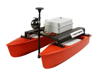
Transmits hundreds of beams simultaneously to produce dense 3D point-cloud maps. It is the standard for bathymetric surveys and structural inspection. EyeROV’s iBoat Alpha, which is an uncrewed boat, can carry multibeam echosounding as a payload for autonomous seabed surveys.
CHIRP Technology in Sonar Systems
Compressed High-Intensity Radiated Pulse (CHIRP) is a method where sound is transmitted through a continuous sweep of multiple frequencies rather than a single pulse. Each frequency returns at a slightly different time, separating targets that would appear merged on conventional sonar. The result is better resolution, better target separation, and more reliable performance at depth.
Scanning Imaging Sonar
Produces a full 360-degree acoustic image from a fixed mount. Used on ROVs hovering at a structure to build situational awareness of the full surrounding environment, not just the forward view.
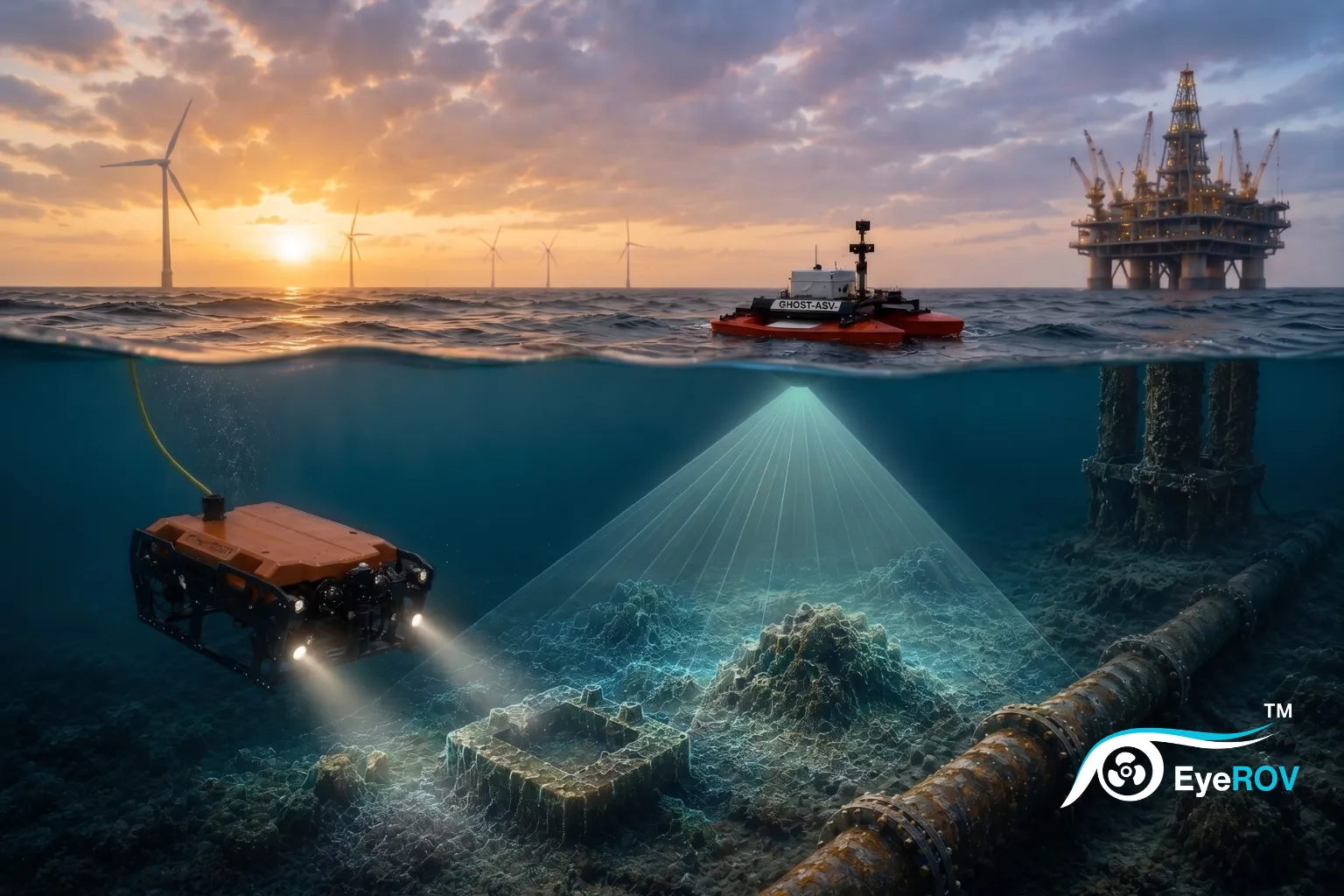
Applications of Sonar
Offshore Inspection and Asset Monitoring
Sonar detects scour around foundations, verifies rock protection, and identifies debris near cables and structures. It provides context that cameras cannot in low-visibility water, which makes it a core tool for offshore oil and gas and maritime inspection.
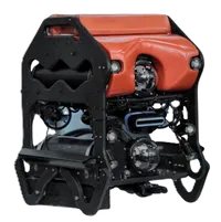
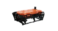
ROV Navigation and Target Detection
Forward-looking sonar gives ROV pilots acoustic imagery of the path ahead, enabling obstacle avoidance and precise positioning near complex structures. EyeROV’s TUNA and SAGARA ROVs are built to carry sonar payloads alongside camera and NDT sensor configurations. The two are designed for different operating conditions, as covered in our TUNA vs SAGARA comparison.
Marine Surveying and Seabed Mapping
Multibeam sonar, a bathymetry tool, produces nautical charts and documents seabed change over time, informing navigation safety and cable routing decisions.
Defense and Security Operations
Naval and coast guard operations use sonar for mine detection, submarine tracking, and harbour security. Passive sonar listens without transmitting, used where acoustic silence is essential.
Search and Recovery Missions
Side scan and multibeam sonar locate shipwrecks, aircraft, and missing persons in open water, covering large areas regardless of visibility.
Benefits of Sonar Scanning Technology
Improved Visibility in Turbid Waters
Sonar functions in turbid water, at depth, in darkness, and in biologically dense environments. These are conditions where cameras and optical systems fail entirely.
Safer Underwater Inspections
Real-time acoustic situational awareness reduces the risk of ROV collision, cable entanglement, and navigation error in confined spaces such as jacket foundations or flooded chambers.
Faster and More Accurate Data Collection
Multibeam sonar covers large areas in a single pass. Combined with EyeROV’s EVAP analytics platform, sonar data is processed and reported faster than traditional diver-based survey workflows.
How Sonar Supports Modern ROV Operations
A camera shows what is directly in front of the ROV. Sonar maps the full surrounding environment in real time, detecting obstacles before the vehicle reaches them and confirming target positions before moving in for close inspection.
EyeROV’s TUNA and SAGARA ROVs support sonar payload integration alongside HD cameras and NDT sensors. The iBoat Alpha can run multibeam sonar surveys in parallel with subsurface inspection campaigns.
What to Consider When Choosing a Sonar System
Water Depth and Operational Environment
Low frequency for greater depth and lower resolution. High frequency for fine detail at shallower depth. Match the frequency range to the operational environment before any other specification.
Imaging Resolution Requirements
Side scan sonar suits general seabed mapping. Multibeam or scanning imaging sonar is needed for structural inspection.
Integration with ROV and Inspection Systems
The sonar device must mount on the vehicle, integrate with its power and data systems, and produce outputs compatible with the inspection data platform.
Improve Underwater Inspection with Advanced Sonar Visibility
Sonar scanning is the foundation of reliable underwater inspection. It functions where no optical system can, and it delivers the spatial data that makes every inspection decision accurate.
If you are evaluating sonar-enabled inspection systems for an offshore or industrial operation, talk to the EyeROV team. To see how sonar applies to a specific use case, read our guide on sonar pipe inspection.
Frequently Asked Questions
Can sonar scanning work in murky water?
Yes. Sonar uses sound, not light, so water clarity has no effect on its performance. It works in turbid, dark, or biologically dense water where cameras fail entirely.
How is sonar used in underwater inspections?
Sonar maps the seabed around foundations, detects scour and debris, surveys cable routes, and guides ROV navigation in low-visibility conditions.
Why is sonar important for ROV operations?
Sonar extends the ROV pilot’s awareness beyond the camera’s field of view, enabling obstacle detection, precise positioning near structures, and safe navigation in confined spaces.
What industries use sonar scanning technology?
Offshore oil and gas, offshore wind, marine surveying, naval defense, ports and harbours, search and recovery, and underwater robotics all rely on sonar scanning as a core operational tool.
What is CHIRP sonar?
Compressed High-Intensity Radiated Pulse (CHIRP) is a method where sound is transmitted through a continuous sweep of multiple frequencies rather than a single pulse. Each frequency returns at a slightly different time, separating targets that would appear merged on conventional sonar. This produces better target separation and higher resolution, particularly in cluttered or deep-water environments.